Lasers find flaws in Scotland's roads
If you've ever bounced uncomfortably along a road with ruts, cracks, and potholes, then optical technology could soon come to your rescue, at least if you travel in Scotland. The Society of Chief Officers for Transportation in Scotland (SCOTS) has initiated a five-year project, costing £3.5 million (US$5.53 million), which uses lasers to find the worst defects in Scotland's road network. The Scottish Road Maintenance Condition Survey (SRMCS) will highlight the sections of road most in need of repair. The general manager of SRMCS is Jim Valentine, from Perth and Kinross Council, and all 32 Scottish Councils are participating.
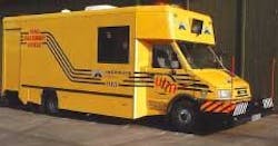
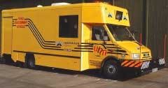
The technology will provide objective data on the condition of the roads. The contractor is WDM (Bristol, Scotland), a company with many years of experience using technology for road surveys. The vehicle-based systems will measure and record the longitudinal and transverse profile of the road, left-and-right-wheel-track-independent rut depths, average rut depth of combined left and right wheel tracks, macro texture, gradient and curvature, and real-time crack detection. Cameras show the view ahead and a global positioning system identifies location.
The laser-based measurements use noncontact laser sensors produced by LMI Technologies (Delta, British Columbia, Canada), each sensor having a resolution of better than 0.05 mm and operating at up to 16,000 readings per second. Each measurement provides a single snapshot of the transverse profile of the road surface, along with measurement of individual left and right wheel track ruts and an estimate of "shoving," or nonstructural rutting. Between 16 and 20 laser displacement sensors are spaced at intervals along a bar attached to the front of the vehicle, providing a measured width of 3.2 m. Data from all the sensors is gathered simultaneously and an average result from each sensor is stored for each 80-mm road length.
The raw data generated by the sensors is compressed before storage; to do this, the measured points are compared to a virtual straight edge to find the wheel ruts and their depths. These figures are recalculated for each 80-mm road length and averaged over a 1- or 10-m section of road. The 1- or 10-m averages are stored and the 80-mm data discarded. At each 10-m boundary, a single transverse 80-mm profile average from all the sensors is also stored. The longitudinal profile of the road is measured using two laser sensors on a beam attached to the front of the vehicle, with compensation for any vertical movements of the vehicle suspension system. Cracks are detected by four high-quality monochrome video cameras with onboard image processing.
Over five years the entire 56,000-km road network will be surveyed at least once, with the A-class roads done annually. The survey will provide an important tool for funding decisions, said Valentine.

